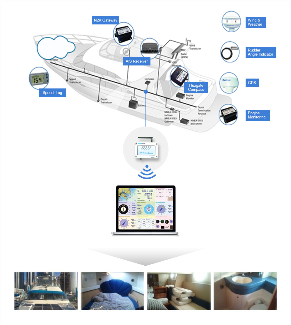
System Diagram
N2K Gateway
Wireless connection interface with N2K network and computer or terminal units
ENC module development
S-57 based ENC (Electronic Navigation Chart) Display AIS interface for monitoring one's own ship, not for navigation
Statistical Analysis
A monitoring system for ship equipment connected to NMEA2000, which supports various platforms, such as Windows, iOS, and Android
- GPS latitude and longitude display
- Altitude, COG, and SOG display
- Steering information display
- Weather information display
- Temperature, water temperature, and air pressure
- True wind direction and true apparent wind display
Boat information at a glance anytime, anywhere
Monitors the current location of surrounding ships and information of one's own ship during boating or leisure activities through wireless smart devices
Secures advanced technical standard of small ships
Developed core technology adjusted to new protocol specification change (NMEA0183→NMEA2000) of navigation communication equipment along with e-Navigation policy progress of IMO.


